Trail Walking Les Allues - Tour Aiguille du fruit depuis Meribel Mottaret. - Photo

Tour Aiguille du fruit depuis Meribel Mottaret.

© OpenStreetMap contributors
Length
Length
29 km
Max alt
Max alt
2541 m
Uphill gradient
Uphill gradient
1655 m
Km-Effort
Km-Effort  
51 km
Min alt
Min alt
1688 m
Downhill gradient
Downhill gradient
1655 m
Boucle
Boucle
Yes
Creation date :
2017-07-08 00:00:00.0
Updated on :
2017-07-08 00:00:00.0

(0 Reviews)

Walking
Walking
7h04
Difficulty : Difficult

Scan this QR Code to open this trail in the SityTrail application

FREE GPS app for hiking

Logo SityTrail SityTrail
IGN / Geographical institutes

Download SityTrail from the App Store Download SityTrail from Google Play

Logo SityTrail SityTrail World
The world is yours!

Download SityTrail from the App Store Download SityTrail from Google Play Download SityTrail on Huawei AppGallery

About

Trail Walking of 29 km to be discovered at Auvergne-Rhône-Alpes, Savoy, Les Allues. This trail is proposed by dalla.anthony.

Description

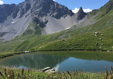
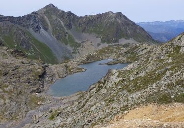
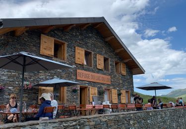
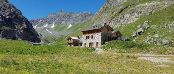
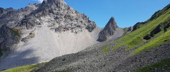
grande et longue randonnée faisant le tour de l'aiguille du fruit en passant par le refuge du saut et le refuge des lacs Merlet.
les temps indiqués sont les temps de marche en allure soutenue avec quelques  poses photo uniquement.
compter 4 heures de plus avec pose pique nique et en allure normale.

Elevation profile

Photos

Points of interest

Point of interest Courchevel - Lac du Pêtre - Photo
dalla.anthony
COURCHEVEL 
Point of interest Les Allues - Refuge du Saut - Photo
dalla.anthony
LES ALLUES 
Point of interest Courchevel - aiguille du fruit - Photo
dalla.anthony
COURCHEVEL 

Positioning

Country:
France
Region :
Auvergne-Rhône-Alpes
Department/Province :
Savoy
Municipality :
Les Allues
Location:
Unknown
Start:(UTM)
310843 ; 5026627 (32T) N.

Trails nearby

Trail Walking Courchevel - lac des creux au départ de l'altiport  - Photo
Walking
Klhn

Walking

Easy
(1)
Courchevel, Auvergne-Rhône-Alpes, Savoy, France
6.8 km | 11.1 km-effort
2h 40min
Yes
Trail Walking Les Belleville - Le sentier des Choumes ( N °9) - Photo
Walking
GUIDE
mumu.larandonneuse

Walking

Easy
Les Belleville, Auvergne-Rhône-Alpes, Savoy, France
6.7 km | 8.8 km-effort
1h 36min
No
Trail Walking Les Belleville - Le sentier Giraud - N° 8 - Photo
Walking
GUIDE
mumu.larandonneuse

Walking

Easy
Les Belleville, Auvergne-Rhône-Alpes, Savoy, France
5 km | 6.5 km-effort
1h 9min
No
Trail Walking Les Belleville - La Croisette  - Le Plan d'eau des Bruyères  - Photo
Walking
GUIDE
mumu.larandonneuse

Walking

Easy
Les Belleville, Auvergne-Rhône-Alpes, Savoy, France
7.7 km | 10.5 km-effort
1h 53min
Yes
Trail Other activity Les Allues - meribel ski 2 - Photo
Other activity
Cricounet84

Other activity

Medium
(1)
Les Allues, Auvergne-Rhône-Alpes, Savoy, France
67 km | 163 km-effort
5h 12min
Yes
Trail Walking Les Allues - Col du Souffre et Lacs Mont-Coua - Photo
Walking
tracegps

Walking

Difficult
(1)
Les Allues, Auvergne-Rhône-Alpes, Savoy, France
25 km | 41 km-effort
7h 0min
Yes
Trail Walking Les Allues - du refuge du Grand plan à Mottaret  - Photo
Walking
bymarc26

Walking

Very difficult
Les Allues, Auvergne-Rhône-Alpes, Savoy, France
15.5 km | 24 km-effort
4h 35min
No
Trail Other activity Les Belleville - Menuires Lac du Loup - Photo
Other activity
jpksenicz

Other activity

Very easy
Les Belleville, Auvergne-Rhône-Alpes, Savoy, France
14.5 km | 21 km-effort
1h 26min
No
Trail Walking Les Belleville - crêtes de Méribel depuis Tougnete - Photo
Walking
bymarc26

Walking

Medium
Les Belleville, Auvergne-Rhône-Alpes, Savoy, France
14.7 km | 23 km-effort
4h 8min
No


Close
My subscriptions